Density & Zoning
How a place looks and feels as a resident, visitor, customer, etc. is all formed by the results of zoning and density. Use this page as a primer on the concepts and review some of the resources shared here to get an idea of what different kinds of density look like.


What is Density?
In simple terms, it is the ratio of housing units per acre of land. Different housing types (e.g. single family homes, garden apartments, high-rise apartments) yield different densities. Density varies greatly depending on, among other things, the area of the land below the building, the unit size, and the architectural design.
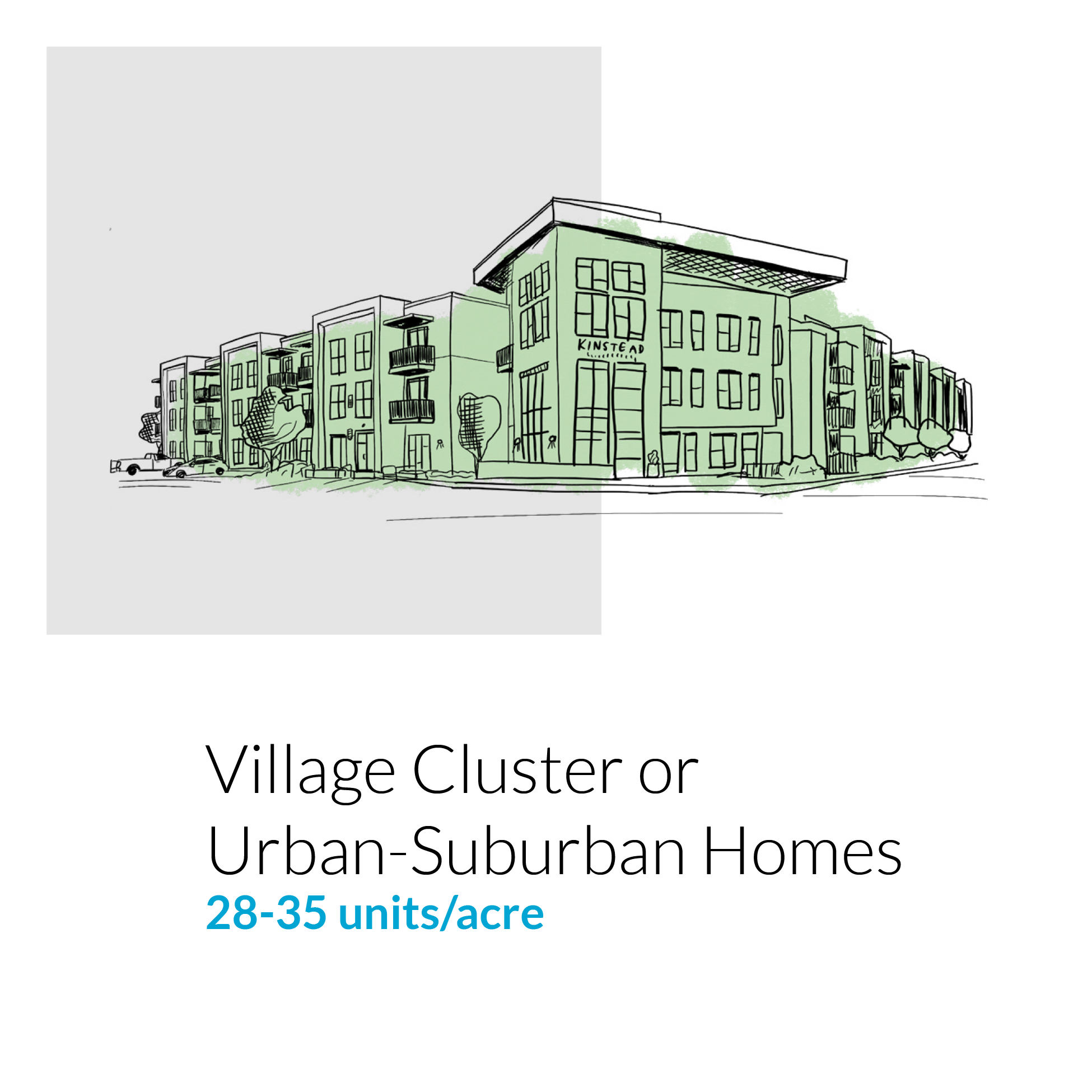
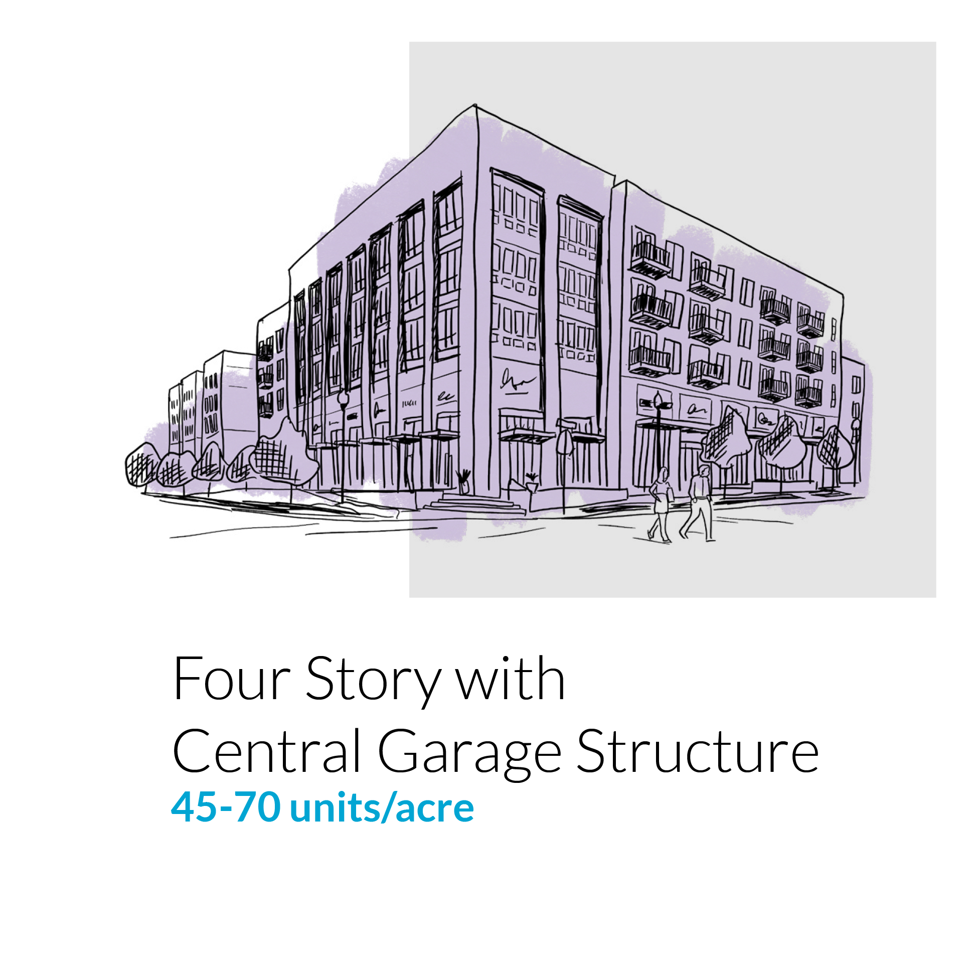
Examples of Density
You can find real life examples of many different housing densities in Lafayette through the self-guided and virtual walking tour. Use this link to access the printable brochure and virtual tour video.
You can also refer to the JHP Density Guide to understand what different densities require to manage height, parking, and architectural style.
Up for a Challenge? Take the “Guess the Density” quiz!
What is Zoning?
Zoning laws regulate the use of land within a municipality. It controls the ways in which the land can be developed and what purposes the zoned land can serve.
Zoning is what keeps a residential district residential, a commercial district commercial, an industrial district industrial, and so on. Zoning dictates what types of properties can co-exist in a particular area within a municipality. For example, some areas are zoned strictly for single-family homes (possibly with exceptions for things like religious buildings or community centers), while certain mixed-used or transitional zoning districts may allow for select businesses and some single and multifamily homes to exist in the same area. On the other end of the spectrum, structures used for heavy industry will be consigned to specifically zoned areas that are purposely kept far away from residential districts.
Historically, zoning has been viewed as a means to preserve the safety and health of a community. It’s intended to ensure, for example, that residents don’t have to live next door to a loud, polluting factory that could potentially harm their health and lower their property values. In the wrong hands, though, zoning has been linked to discrimination, with critics arguing that it has contributed to racial and economic segregation in many areas.
Zoning laws can also regulate more specific details of construction, such as maximum building height, minimum lot size or how far a house needs to be setback from the road. While it is an important piece of regulation, zoning is not set in stone. As such, zoning regulations can and should be updated to reflect current and future community needs and changes in land uses and is usually updated along with the City’s General Plan.
How Does Zoning Work?
Zoning helps create and mold the structures of our cities and towns, ideally in a way that make the most sense for the people living there in terms of how they live and move within the area. When making decisions about a city’s zoning, planners consult the General Plan, which is the comprehensive document that lays out what a particular municipality’s current and future needs and goals are.
The General Plan takes into account a community’s transportation needs, its economy, its obstacles and challenges, and the people, homes, parks and businesses that make up that community. Once a General Plan is in place, a zoning ordinance can be created, drawing on the goals and needs outlined in the master plan. The zoning ordinance is what helps put a city’s plans into action; it’s a document that lists all the regulations and laws that govern how land can be used and maps out exactly what the boundaries of the area’s different zones are.
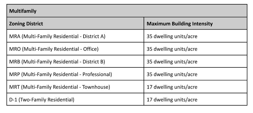
Zoning and Density in Lafayette
Each parcel in the city is assigned both a Zoning Designation and a “General Plan land use designation”, which, in addition to identifying the context and purpose of each designation, also sets the maximum density for residential land uses. The designations are laid out in the Land Use element of the General Plan. Below is a table summarizing the residential density allowed in each of the city’s current zoning districts.
You can use the City’s Community View map to check the zoning of any parcel in the City in addition to other information!